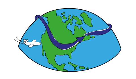

Jet stream and stormy weather
by Kirsty McCabe, FRMetS
Terrible winter? Blame it on the jet stream. Great summer? Praise be to the jet stream for being in the right place (in other words, not over the UK!).
But what exactly is this jet stream that everyone keeps talking about, and why does it have such a large influence on our weather?
What is a jet stream?
A jet stream is defined as a narrow zone of very strong winds thousands of miles long and hundreds of miles wide. These fast flowing air currents are typically found about 30,000ft above the surface of the Earth and are caused by atmospheric heating and our planet's rotation.
The UK's jet stream, known as the polar jet, forms at the boundary of two very different air masses. To the north we have cold polar air, while to the south we have warm tropical air. This temperature difference leads to a pressure difference and the result is a movement of air, or wind, to try to equalise things. Large differences leads to strong winds. Add in the Earth's rotation and the strong winds are forced to move around the globe from west to east like a fast-moving stream.
On average jet streams travel at about 110 miles per hour. But in the winter, when the temperature difference between warm and cold air masses are more dramatic, jet streams can go much faster – 250 miles per hour or more.
As well as our polar jet that flows over the middle to northern latitudes of North America, Europe and Asia, there is also a higher but weaker subtropical jet, and of course the southern hemisphere has its own polar and subtropical jets. The subtropical jet is located at 30 °N and 30 °S, but is only present in wintertime when the temperature contrast in the subtropics is strong enough to form jet winds.
These are the big four of the jet stream world but others also exist. For example, during the northern hemisphere summer, easterly jets can form in tropical regions where dry air meets more humid air at high altitudes. Low-level jets also are typical of various regions such as the central United States.
Who discovered the jet stream?
We pretty much take the existence of jet streams as read these days. But who first discovered these narrow ribbons of fast-moving winds high up in our atmosphere?
A Japanese meteorologist called Wasaburo Ooishi is often credited with the first discovery back in the 1920s when he used weather balloons to track upper level winds near Mount Fuji. In 1934, American pilot Wiley Post was attempting to fly solo around the world and noticed differences between his ground and air speed measurements.
But it wasn't until 1939 that German meteorologist Heinrich Seilkopf used the term jet stream in a research paper. Well he actually used the term Strahlströmung which means “jet streaming”. Knowledge of the jet stream increased rapidly in the years that followed during World War II, as pilots noticed variations in winds when flying between Europe and North America.
Jet streams are located in the middle and upper parts of a layer of the atmosphere called the troposphere. This is the height that aeroplanes fly as well so it's no suprise that modern pilots now harness the power of the jet stream. Flight times and fuel consumption are dramatically affected by flying either with or against winds that can reach over 200 miles per hour. If you've ever flown from the UK to the USA you might have wondered why the plane was going such a roundabout route rather than straight across or why the return flight was so much quicker.
Follow that jet
When it comes to weather forecasting, it pays to know where the jet stream is. Despite being way up high, jet streams have a direct impact on what's happening on the ground as the strong current of rapidly moving air pushes weather patterns around the world. As a result, most weather systems don't just sit over an area but are moved along by the jet stream.
Over the North Atlantic our polar jet typically steers weather systems in a west to east direction. If the jet stream remains in a fixed or stationary pattern, then you can expect frequent spells of wet and windy weather to affect the same region. On the plus side, that usually means milder than normal conditions during the autumn or winter months. However, repeated bouts of strong winds and heavy rain have devastating impacts.
In October 2022, the polar jet was in just the right (or is that wrong?) position to steer low pressure systems across the British Isles, bringing mild but unsettled conditions. Temperatures were unusually high, both by day and by night, but spells of warm sunshine were rudely interrupted by blustery bands of rain. More dramatically, a squall line of thunderstorms moved over southern England on 23 October 2022, bringing torrential rain, high gusts, frequent lightning and even reports of tornadoes. TORRO, the Tornado and Storm Research Organisation, confirmed a tornado had touched down in Hampshire, damaging properties, trees and even a zoo.
Footage of yesterdays tornado in Hampshire. TORRO have investigated & reviewed the footage and have confirmed it was a tornado.
— Met4Cast (@Met4CastUK) October 24, 2022
Other tornadoes have been reported in Welling & London but these still need confirming. pic.twitter.com/hZC6KLOSeg
A lot of data to process, but initial estimates are of a T2/T3 tornado and a provisional damage path of 3.5km. These may be revised when analysed further and a return visit may be made.
— Sarah (@Sarah_Hants) October 26, 2022
All photos copyright TORRO. pic.twitter.com/43PRLXAWJu
Bend and buckle
Our jet stream doesn't always flow nicely from west to east, in fact jet streams change position, location and strength depending on the season. During the winter months, the jet is at its strongest thanks to the greater contrast between the cold polar air and warm tropical air. As well as these seasonal variations, if warm air moves further north than normal or cold air further south, it can cause the jet stream to buckle, like a meandering river. This means weather systems such as areas of low pressure are moved towards different regions or blocked altogether.
If this happens in winter, the blocking can lead to a bitterly cold spell, as mild westerly winds are replaced by cold continental air from the east aka The Beast from the East. When the blocking happens in summer, it can lead to droughts and heatwaves and even a heat dome.
How might climate change affect the jet stream?
There is some research that suggests the jet stream is weakening due to a reduction in the temperature contrast between the equator to the pole as the Arctic has warmed at roughly twice the rate as the entire globe – scientists refer to this as ‘Arctic amplification’.
But there is also some research to suggest that tropical storms will be able to reach higher latitudes as global temperatures rise, and this could interact with and strengthen the jet stream.
How does the jet position affect UK weather?
If the polar jet is far to the south of the UK, you can expect colder than average weather. If it's to the north of the UK, we will be warmer than average, and hopefully nice and settled too. And, of course, if the jet is over the UK, then we will get frequent wet and windy conditions.


