
An unusually active storm season?
Storms often hit the British Isles during the autumn and winter months, with the strongest ones living on in our memory for decades, such as the Great Storm of 1987, the Burns Day Storm of 1990 and the St Jude Storm of 2013.
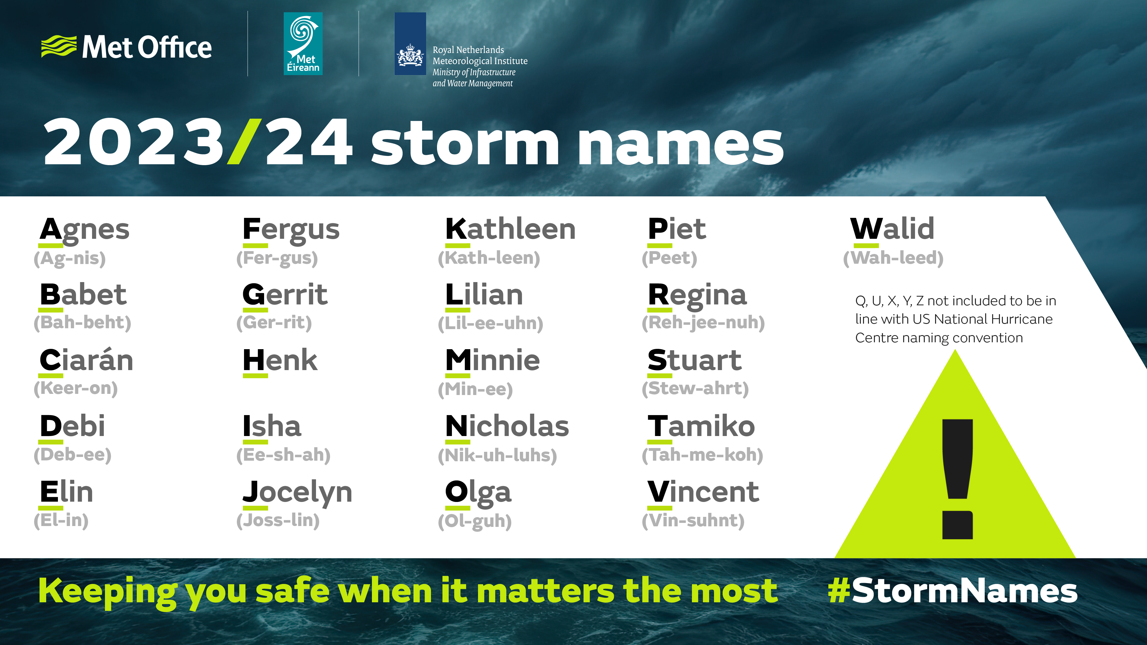
In 2015, the UK began officially naming storms to raise awareness and improve communication of severe weather events.
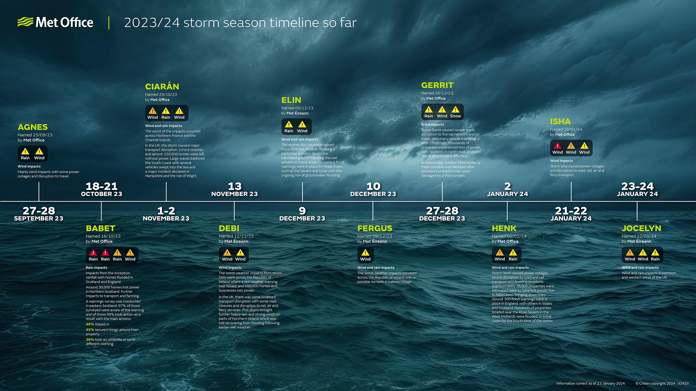
Over the years the number of named storms has fluctuated, with some seasons more stormy than others. That’s certainly the case with the 2023-24 season, which reached storm number 10, aka Jocelyn, named on 22 January 2024. That’s the earliest we’ve reached the letter ‘J’ and only the second time we’ve got that far down the list since storm naming began. Back in the first year the UK began naming storms we reached Katie, named on 25 March 2016.
But what actually is a storm? In short, it’s a deep area of low pressure or depression, often one that has undergone explosive cyclogenesis. Such deep low-pressure systems frequently develop over the North Atlantic and track past the UK and onto Scandinavia. But they can track at lower latitudes affecting other parts of Europe.
#StormIsha has been named by the Met Office and is forecast to bring strong winds and heavy rain to the UK later on Sunday and into Monday
— Met Office (@metoffice) January 19, 2024
Stay #WeatherAware ⚠️ pic.twitter.com/BLC8jTpUC1
Storms get named when they are deemed to have the potential to cause medium or high impacts, with wind the primary consideration, although rain and snow are taken into consideration. Timing and location are important too. In early autumn the trees are still in full leaf and therefore more vulnerable. Western coasts of Ireland and Scotland are more often affected by storms, but southern parts of the UK are much more susceptible to strong winds, so pinning down the track of a storm is crucial.
But could the 2023-24 storm season be classed as unusual, and are there underlying factors at play? The UK Met Office has taken a closer look.
What’s behind the storms this year?
To look at why we have such a stormy season, we need to look at one of the drivers of the UK weather — the jet stream.
The jet stream greatly influences the weather we experience, and a stronger, more active jet stream will help deepen low pressure systems, sending them our way. If the jet stream remains in a fixed position, you can expect frequent spells of wet and windy weather to affect the same region.
In early 2024, a pool of very cold air sunk southwards across North America. The temperature contrast here intensified the jet stream influencing the development of Storms Isha and Jocelyn.
What’s the trend in named storms?
As storms have only been named by the Met Office since 2015, using the storm name list to assess the impact of climate change isn’t statistically robust because the time period is far too short. Climate scientists typically use long-running datasets that compare decades and centuries to assess the impact of human emissions on long-term weather and climate trends.
In addition, storms are named by meteorological organisations subjectively based on their likely impacts, so it’s not an objective observation-based dataset in terms of measuring the effects of climate change.
One reason people might perceive there to be more storms could be the increase in media and social media coverage when impactful weather is around compared to historical weather events.
However, the Met Office’s long-term climate statistics do give a view of impactful weather in the UK in previous decades.
Climate change and windstorms
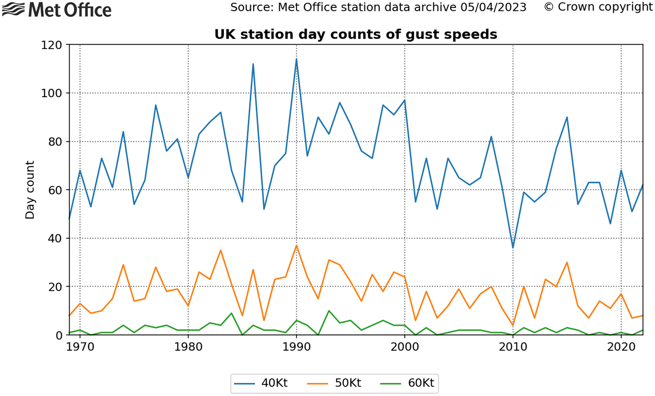
If you ignore the introduction of named storms in 2015 and look at the longer term Met Office UK climate statistics, it remains hard to detect trends in the number and severity of wind events in the UK.
Dr. Amy Doherty is Science Manager of the National Climate Information Centre at the Met Office. She explained: “The UK has a history of impactful storms stretching back hundreds of years, long before the introduction of named storms in 2015.
“One thing that is clear from observations is that there’s big variability year-to-year in the number and intensity of storms that impact the UK. This large variability is related to the UK’s location at the edge of continental Europe and relatively small geographic size, so small changes in the position of the jet stream — which puts us in the path of low-pressure systems — can make a profound difference in the weather we receive.
“This large variability means that we have to be particularly cautious when analysing the data. In our observational records, it’s hard to detect any trend one way or the other in terms of number and intensity of low-pressure systems that cross the UK. While our climate overall is getting wetter, there are no compelling trends in increasing storminess in recent decades. Recent stormy seasons — such as that of 2013-2014, before the storm naming system was introduced, clearly illustrate the fundamental problem with drawing conclusions from a simple count of the number of named storms.”
“It is difficult to predict how extratropical cyclones are being and will be affected by climate change because there are several different influences on them that are likely to be affected by climate change. There is some evidence though that storms with strong winds (windstorms) will become slightly more frequent in the future in northwest Europe and also become more “clustered”, so that we experience several storms one after the other. There is strong evidence that on average storms will produce more rainfall and some studies have also predicted an increase in the strength of the winds in the strongest storms.”
Natural factors also play a role in the number of storms that affect the British Isles. Suzanne Gray, Professor of Meteorology at the University of Reading, says "The number of storms that impact us each year can be influenced by meteorological phenomena occurring elsewhere across the globe such as the current El Niño event in the tropical Pacific region."
Most climate projections indicate that winter windstorms will increase slightly in number and intensity over the UK as a result of climate change, with more rainfall. The storms are likely to become more clustered too, so that we experience several storms, one after the other
However, there is medium rather than high confidence in this projection because some climate models indicate differently. And over the recent decades there has been little difference in storminess, mean wind speed or maximum gusts, as reported in the State of the UK Climate 2022.
Year-to-year variability in storm frequency and intensity will continue to be a major factor in the future climate. We can, however, be confident that the coastal impacts of windstorms, from storm surges and high waves, will worsen as the sea level rises.
More storms to come this year?
After Storm Jocelyn this week, the UK will continue to see spells of wet and windy weather, especially in northern and western areas. Long range models suggest that late January and early February weather could see some drier interludes further south, while wet and windy weather remains possible in the north and west.
In terms of what this means for named storms, it’s too early to pick out when the next one might be, but there remains a chance of further impactful weather as we move through meteorological winter and into spring.
Find full information on storm name seasons from the Met Office at the UK Storm Centre.


