
Life cycle of a thunderstorm
Thunderstorms are something we take for granted. After all, they are pretty common and can occur anywhere on the planet.
Right now, approximately 2000 thunderstorms are happening around the world, with 100 lightning strikes every second and 8 million lightning strikes a day. Thundery downpours can clear hot muggy air, and lightning strikes helps the Earth maintain electrical balance and make ozone-producing chemicals.
But how much do you really know about thunderstorms? How does that cute little fluffy cumulus cloud turn into a big threatening thunderhead? It happens in three stages – the developing stage, the mature stage and the dissipating stage.
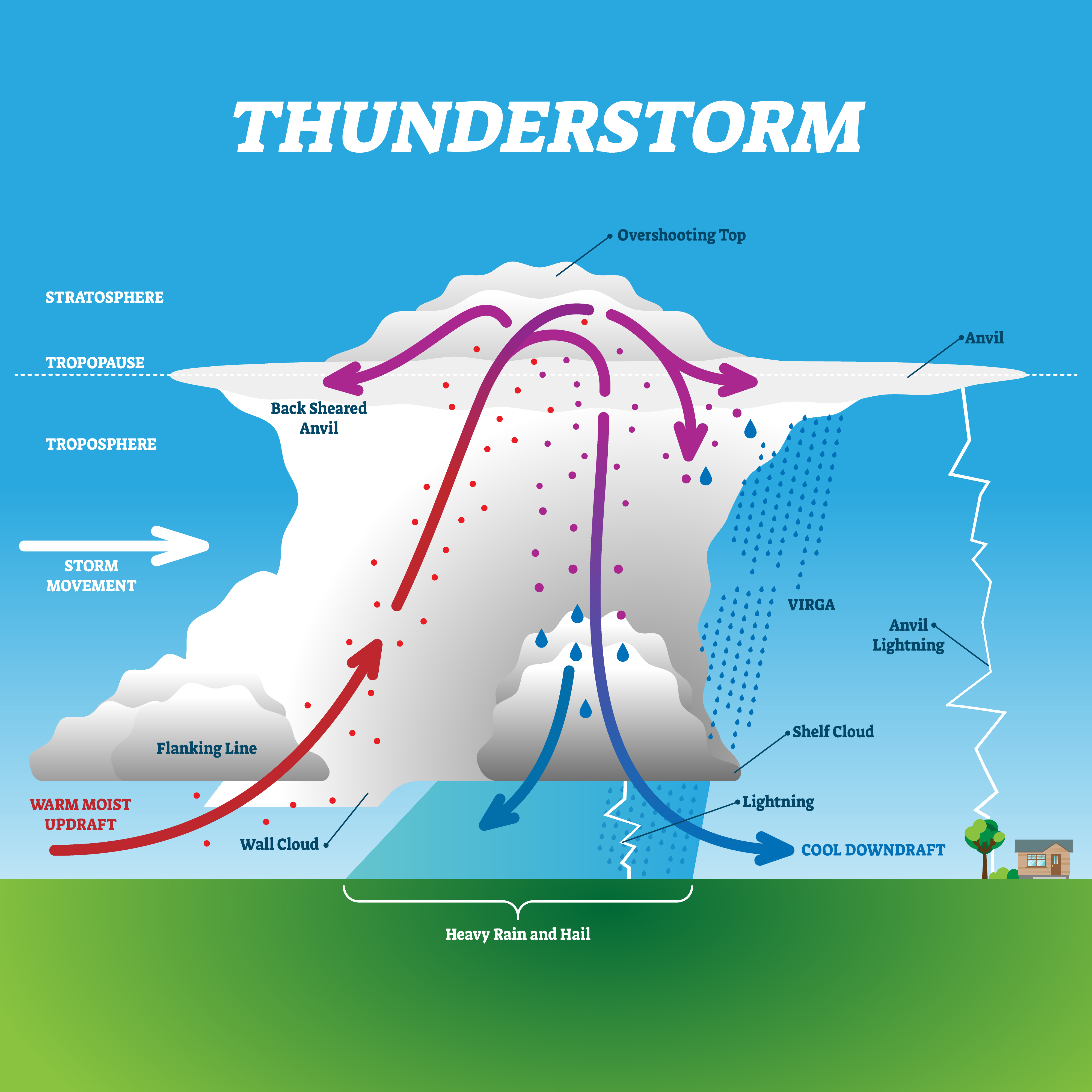
Cumulus clouds form when moist warm air rises, cools and condenses. If the updraught of warm air continues the cloud soon looks like a tower – hence the name towering cumulus. These are a heads-up that storms are brewing. There is little to no rain at this developing stage but you can get occasional flashes of lightning.

The cloud will eventually grow upwards into areas where the temperature is below freezing, creating ice crystals that the upper level winds fan out to form the classic anvil shape at the top of a cumulonimbus cloud. Ice at the top of a tall cloud is an essential ingredient for the thunder and lightning associated with thunderstorms.

Thanks to the millions of collisions between the ice particles and water droplets bouncing around within the cloud, an electric charge builds up. When the electrical charge becomes sufficiently separated in a thundercloud, with some regions acquiring a negative charge and others a positive charge, a discharge of lightning becomes likely. In turn, a positive charge can build up on the ground beneath the cloud, on anything that sticks up such as mountains, people or trees. About one third of lightning flashes travel from the cloud to the ground, most of these originate in the negatively charged regions of the cloud.
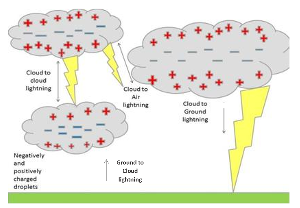
When the charge coming up from the ground connects with the charge coming down from the clouds then – flash – we’ve got a lightning strike. The air surrounding the lightning channel briefly reaches temperatures of up to 30,000°C, causing the air to rapidly expand, which we hear as thunder. Thunder and lightning occur at roughly the same time, but you see the flash first as light travels much fast than sound.
We're now entering the mature stage of our storm when the updraught of rising air continues to feed the storm, but the water vapour in the cloud has formed heavy enough water droplets that precipitation begins to fall, and this creates a column of air pushing down. This downdraught and rain-cooled air spreads out along the ground to form a gust front. It's at this stage we're most likely to get hail, heavy rain, frequent lightning, strong gusty winds and even tornadoes.
If you remember from the developing stage, storms need something to nudge the air to rise. Sometimes the gust front, the cool outflow of a mature thunderstorm, can create that nudge or lift, and in turn lead to the development of a new thunderstorm.
Eventually, the rising updraught is overcome by the cool downdraught and the storm begins to dissipate. The gust front cuts off the warm moist air that was feeding the thunderstorm, rainfall decreases but lightning remains a danger until the storm is all rained out and often all that's left is a wispy anvil of cirrus cloud, high up in the sky.
The entire thunderstorm life cycle from growing cumulus cloud to dissipated storm takes an hour on average with less than 30 minutes of thunder and lightning. If it lasts longer then there is more than one storm cloud present.
Did you know?
- Because moisture and warmth are crucial to thunderstorms, they occur more often in the spring and summer, particularly in humid areas. And they are most likely to happen during the afternoon and evening hours when temperatures are at their highest.
- The most thundery part of the Earth is the island of Java, which averages about 220 thundery days a year. In comparison the UK gets between 5 and 20 thundery days each year, with the majority occurring during the summer over the east Midlands and parts of southeast England.


