Cyclone Gabrielle causes national state of emergency in New Zealand
by Kirsty McCabe, FRMetS
New Zealand declared its third ever national state of emergency in February 2023, following the passage of Cyclone Gabrielle, with the government attributing the scale of the disaster to climate change.
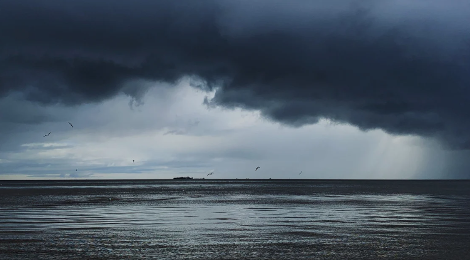
For those living in Auckland, the country’s largest city, the extreme weather was particularly unwelcome as they were still recovering from their wettest day on record just a fortnight earlier. At least four people died following January’s torrential thundery downpours, which led to significant damage and flooding across Auckland and the North Island.
Record breaking rain in Auckland. Although the heavy band of rain has moved off to the east there is still a change of showers so the total for rainfall could climb even higher. The impacts of the last 24 hours will be felt by many in Auckland for a long time. Take care out there pic.twitter.com/kiIm6Tsrro
— MetService (@MetService) January 27, 2023
- Auckland had its wettest day with 280mm at Albert Park (211mm of that fell in under 6 hours)
- In less than an hour, a month's worth of rain fell at Auckland airport (equivalent to January's rainfall)
- Unsurprisingly, January 2023 was the wettest month since records began, with 539mm of rain at Albert Park
The National Institute of Water and Atmospheric Research, the country's climate science body, said 27 January was the wettest day on record for a number of locations, describing it as a 1-in-200 year event.
27 Jan 2023 - provisionally, the wettest day on record for multiple locations in Auckland.
These locations have set a new all-time daily rainfall record.
This is approximately an entire summer's worth of rain (DJF) in one day! 😮 pic.twitter.com/6twfPst3tW— NIWA Weather (@NiwaWeather) January 27, 2023
The torrential rain prompted widespread flooding, evacuations and flight cancellations. Footage and images online showed people trapped in waist-deep floodwater, rescuers carrying out evacuations on kayaks, and grocery items floating down supermarket aisles.
An unusual combination of environmental factors led to Auckland’s wettest day in history; a formidable La Niña, a marine heatwave and a nearby subtropical depression led to more moisture being available. A trough in the jet stream and converging winds over the city led to an entire summer’s worth of rain falling on the city in less than a day.
As the residents of Auckland recovered, attention shifted to a new threat. Long-range forecasts indicated a tropical cyclone could bring severe weather mid February, so New Zealand's MetService provided early insights and important communications.
A low over the Coral Sea is expected to develop into a Tropical Cyclone, then move southeastwards towards NZ. It may bring severe weather to northern parts of the country from Sunday onwards https://t.co/ePtVj8v6Kx ^PL pic.twitter.com/Iw7GGgbUQr
— MetService (@MetService) February 7, 2023

The far north of New Zealand has a subtropical climate and does occasionally catch the tail end of tropical systems. Currently, an average of about 10 tropical cyclones form in the South Pacific tropics between November and April each year, and about one of those will affect New Zealand as an ex-tropical cyclone (usually in February or March).
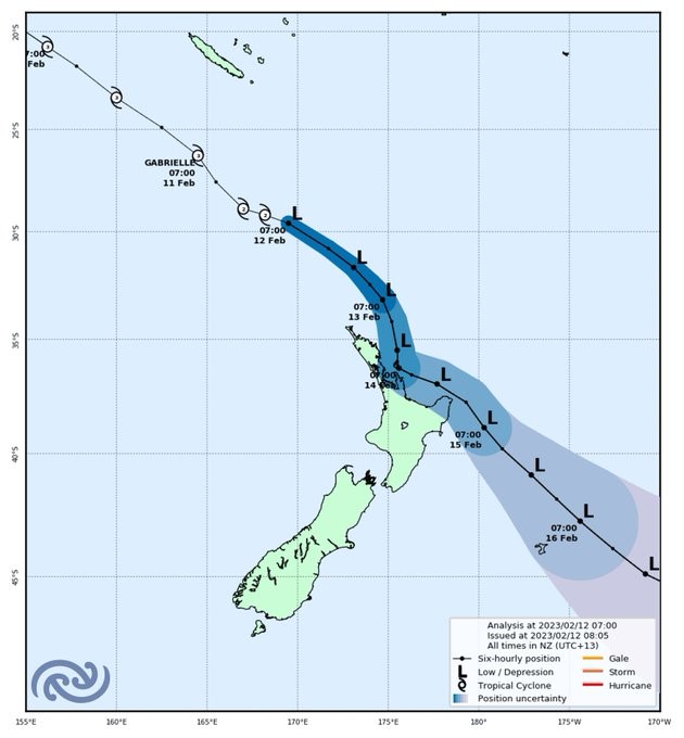
But don’t be fooled by the reclassification of tropical to ex-tropical, as these storm systems can still bring severe weather. As was the case with Gabrielle. This tropical cyclone reached severe category 3 in the South Pacific, before transitioning into a deep subtropical low and heading to New Zealand.
🔴Red Warnings for Heavy Rain have been issued for the Coromandel Peninsula and Tairawhiti/Gisborne north of Tolaga Bay#CycloneGabrielle is expected to bring significant impacts to these areas
Keep up with the latest Severe Weather info at https://t.co/qHyE5zzql5 pic.twitter.com/7e3HCf71wg— MetService (@MetService) February 11, 2023
It's looking very wet around the Gisborne Tairāwhiti region to start the week.
A Red Heavy Rain Warning has been issued for the area north of Tolaga Bay.
Here's a look at what the weather could look like on Monday.
Find the full warning details at https://t.co/qHyE5zzql5 pic.twitter.com/jaXP2MnH4a— MetService (@MetService) February 11, 2023
Multiple heavy rain and wind warnings were issued across the North Island as Gabrielle approached. States of emergency that were already in place in Auckland and the Coromandel as a result of January's floods were extended.
The size of Cyclone Gabrielle is clear in this video.
Since noon, we're recorded gusts of 150 - 160 km/h, and some stations in Gisborne have recorded rain rates of 15 - 30mm in a single hour. pic.twitter.com/1dZ1A4dxEU— MetService (@MetService) February 13, 2023
Gabrielle affected the North Island and the top of the South Island from 12 to 16 February, with a national state of emergency declared on 14 February. About half of the country’s population was affected, with around 10,000 forced from their homes, and at least six people lost their lives.
Strong winds led to widespread power outages and property damage, while heavy rainfall caused severe flooding and landslides. The military helped with evacuations and delivered supplies to the worst-affected parts of the North Island.
While New Zealand has been affected by ex-tropical cyclones before, climate change is more than likely to blame for the intensity of Gabrielle, which brought more destruction to the country than any weather event in decades. And it doesn't bode well for the future, as a warming atmosphere will increase the intensity and frequency of extreme rainfall events.
A study published at the end of March 2023 by the World Weather Attribution found that the rainfall from Gabrielle was about 30% heavier, and that climate change undoubtedly played a role.