
Forecasting in the Channel Islands
Picture the scene. It’s a Tuesday afternoon in October 2021 and you are settling into your shift on the bench in the Jersey Met forecast office after handover. The weather is relatively calm apart from a bit of breeze and a few showers, but nothing unusual for the Channel Islands in Autumn. However, you know it is going to get a lot worse over the next 36 hours. There’s a depression brewing out in the Atlantic, and while it’s not forecast to deepen significantly, it is looking increasingly likely that the strongest winds around the western flank of the low are going to swing somewhere near or over the islands.
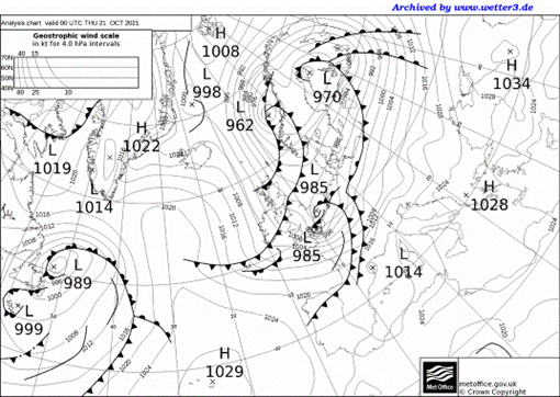
The next update to the forecast model arrives, which now suggests a swathe of severe gale F9 to storm F10 winds for Jersey during the early hours of Thursday. Just as you are assessing the likelihood of this developing storm, and the attendant risks, an email pops into your inbox from Meteo-France, who have named it Storm Aurore. After comparing the latest data to other output and reading the model guidance again, you raise your concerns with the Head of Meteorology. Before long you have prepared the local gale warning, updated the shipping forecast, and have got the ball moving with the Jersey Severe Weather Group, who are now meeting up to consider the risks and actions. Welcome to another day forecasting at Jersey Met.
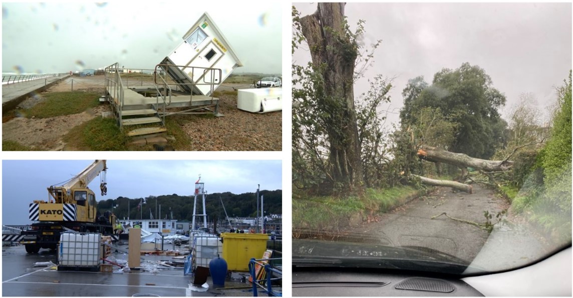
Photographs from ITV Channel News showed the damage caused by Storm Aurore across the Channel Islands.
The weather in the Channel Islands is highly changeable and can swing from benign to a full-on squall and back again, sometimes in a matter of minutes. Along with trying to predict the chance of a storm hitting the Channel Islands, we also have the challenge of forecasting fog, thunderstorms and even snow at times. All these present their own problems and are particularly tricky to predict for a small set of islands surrounded by the sea, sitting only around 15 miles from the coast of Normandy.
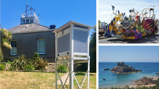
Jersey Met are a small team of dedicated forecasters who predict the weather 24 hours a day, 365 days of the year. The office has a proud and long forecast and observing heritage with climate records at Maison St Louis Observatory stretching back to 1894, qualifying it as one of only eight World Meteorological Organization ‘Centennial Observing Stations’ in the British Isles. Observations and climate records were originally kept by Jesuits, but nowadays most of the observations are automated, with forecasting carried out by an experienced team of 10 operational staff, supported by a small management team.

I joined the team in October 2018 after seeing a vacancy for a Senior Forecaster in a Royal Meteorological Society newsletter. I knew very little about Jersey Met at the time but thought the job sounded interesting and after some background research, I decided that I was ready for a change. I am a keen walker, photographer and surfer, and Jersey was particularly appealing given the quality of its beaches and waves, not the real reason I moved here (honest!), but certainly the icing on the cake. We decided to throw caution to the wind, sell up and move over lock, stock and barrel in 2018 and are still here 5 years later. The island itself is stunning, wrapped by superb world class beaches with often crystal-clear water and beautiful coast paths. When the sun is shining, which it often is, there is nowhere else I would rather be.
Despite periods of occasionally unsettled weather, the climate in Jersey is very pleasant with warm and sunny weather dominating between May and September, with Jersey officially the sunniest place in the British Isles. 2022 was an exceptionally warm year, with record-breaking heat in the summer when the temperature reached 37.9 °C in Jersey on 18 July. Winters tend to be on the mild side with the odd cold and frosty day here and there, but snow is infrequent. The islands are dominated by a west to southwest maritime climate, but we also frequently see winds from the east or northeast which make for drier and sunnier weather, especially during the summer when we benefit from some extra heat from nearby France.
Jersey has a strong French influence with road and place names mostly in French and a small proportion of the island population still speaking Jersey French or Jèrriais as it is known, giving Jersey a bit of an exotic feel. Crime is low, schools are very good and all-in-all it is a very safe place to live. Of course, all these things filter into the cost of living with the average property now costing more in Jersey than in London. Goods and services are also generally more expensive than the UK, which are all things to factor into a decision to move to the island.

The work at Jersey Met is broad and varied and no two days are ever the same, but we always work closely with our customers. During a typical shift, the forecaster creates bespoke aviation and marine products, produces forecasts for the public, including radio broadcasts, and issues any warnings. If you are a meteorologist looking for new challenges and a better work-life balance, a move to Jersey may just fit the bill!
About the Author

Matt Winter has been a forecaster since joining the UK Met Office in 2003.
He started his career working in RAF bases across the UK and deployed frequently with the Mobile Met Unit, supporting military detachments across the globe. In 2013 Matt joined the Flood Forecasting Centre in Exeter, working as a Hydrometeorologist which gave him valuable experience use probabilistic forecasting methods and issuing impact-based forecasts and warnings.
In 2018 he was ready for a new challenge and started working as a Senior Forecaster in Jersey Met, using all his previous skills and experience and adapting them to a new set of products and services, supporting businesses, services and life in the Channel Islands.
In July 2022 Matt was promoted to Senior Manager and now helps to manage and shape the Jersey Met forecast team of the future.
 © Ed Hawkins, University of Reading")


