
Rainfall radar
Radar is one of the best tools in a forecaster’s kit, allowing us to see where in the UK it’s raining, how heavy the rain is, how quickly the rain is moving, and even whether it’s rain, sleet or snow (crucial during the tricky winter months). But how does it work, and why does it sometimes get it wrong?
RADAR stands for RAdio Detection And Ranging and uses radio waves to detect the presence, direction, distance and speed of objects, such as aircraft, ships or weather formations. Here’s a quick overview of how it works in the weather world.
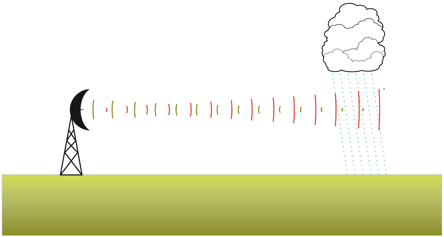
- A radar antennae emits short pulses of radio waves into the atmosphere, these travel outwards in all directions.
- If the radar pulses encounter any raindrops, snowflakes or hailstones, a portion of the beam is scattered back towards the radar antennae.
- The strength of these echoes and the time it takes them to return, allows the system to determine the location and intensity of precipitation (rain, hail, snow) in the atmosphere.
- The radar station completes a series of scans every 5 minutes, giving good data out to about 75km and useful data to 255km, as the accuracy decreases with range and altitude.
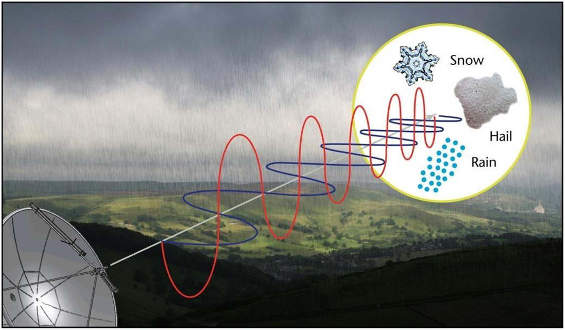
- Doppler radar technology is used to work out the speed and direction of the precipitation.
- The characteristics of the returned radar signals, especially the shape and strength, allow the radar to differentiate between rain, sleet and snow.
The positioning of a radar station is crucial to ensure as many places are covered as possible, but the height of the dish is also crucial. Too low and objects can block the beam; too high and it might be above the freezing level and report ice or snow when it is actually rain at ground level. A network of radar stations across the British Isles (15 in the UK, 2 in Ireland and 1 on Jersey) gathers together all the data and creates the composite radar pictures, with the rainfall rate typically illustrated by colour intensity bands.
There are times when the radar “gets it wrong”. For example, when it’s raining outside but nothing is showing on the radar. Or the other way round. That can happen with drizzle, as tiny drizzle droplets falling from low-level clouds can be missed unless falling close to the radar. The curvature of the Earth also plays a role, with echoes coming from an increasingly higher level the further away precipitation is from the radar. At around 100km, the radar beam will be at a height of 1.5km. So it could miss rain falling from clouds below that level.
There are other known weaknesses with radar, so it’s important that meteorologists don’t rely on radar images alone to monitor rainfall. Other observations must be taken into account, such as satellite imagery, temperature profiles and surface reports.
Some of the common errors are:
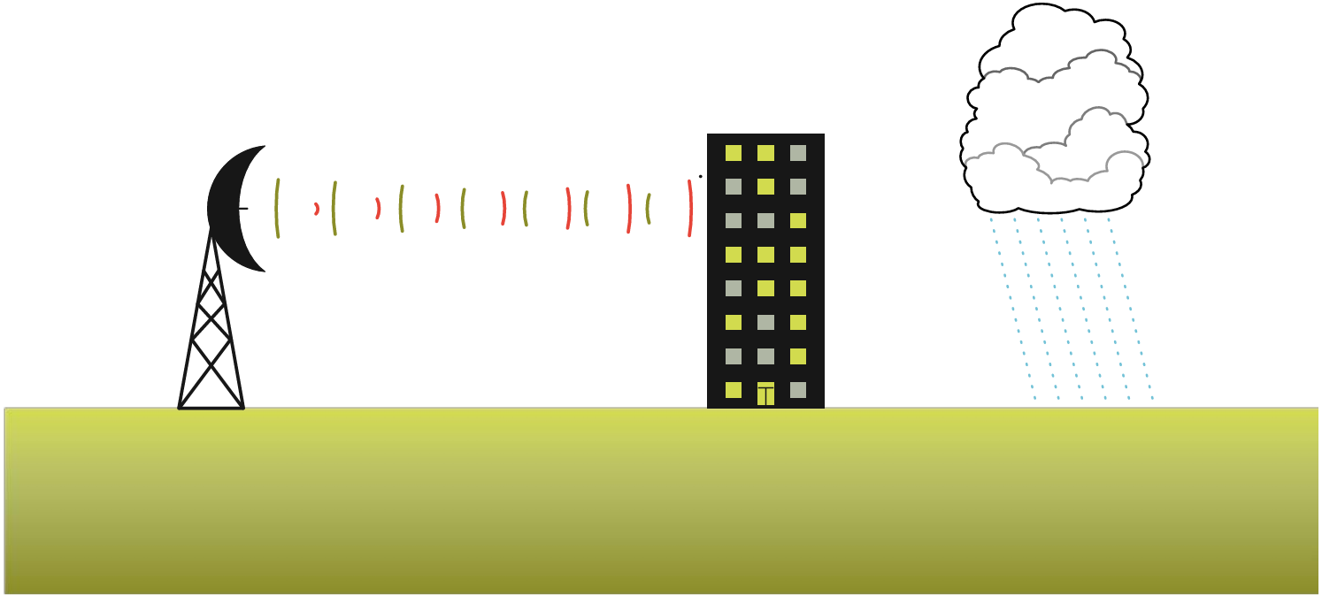
Clutter: It’s not just rain that reflects the radar beam. Radar echoes can be reflected off stationary objects on the ground, such as buildings, trees or hills, producing false echoes known as "ground clutter." Ground clutter can reduce the accuracy of rainfall estimates, particularly in urban areas. If the radar beam is obstructed by a tree, hill or building it's called "occultation".
Short-live spurious echoes can be caused by ships, aircraft, technical problems or even birds and insects. Luckily the reflectivity of an ant is rather different to that of a raindrop, leading to a tell-tale “clutter” pattern on the radar. A quick check with satellite imagery, rain gauges and even social media, will soon reveal the truth.
Bright banding: Sometimes the presence of melting snowflakes can lead to a bright band on the radar imagery that gives the false impression of a zone of heavy rain. The bright band is actually due to the large reflective surface of the melting snowflakes, which give strong echoes as they collapse into raindrops. It can lead to an overestimation of rainfall intensity, so definitely worth looking out for during rain/snow events.
Attenuation: Radar signals can weaken (attenuate) as they pass through heavy precipitation, such as intense thunderstorms or heavy rain showers. This weakening can lead to underestimation of rainfall intensity or errors in precipitation measurement, especially in regions of intense rainfall.
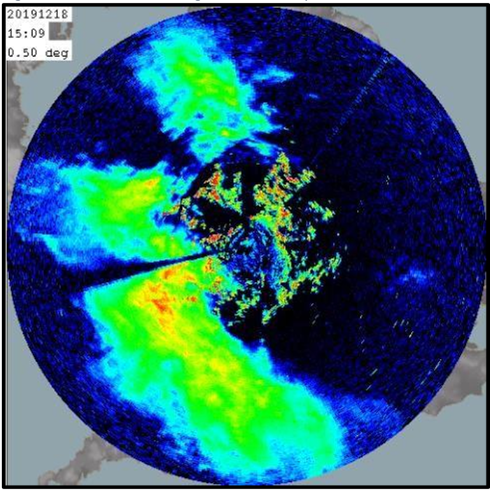
AnaProp or Anomalous Propagation: Radar beams are similar to light beams, in that they travel in straight lines unless passing through air of varying density, in which case the radar beam will bend or refract. During anticyclonic conditions in the UK, a low-level temperature inversion bends the radar beam downwards and strong (false) echoes are returned from the ground. Americans refer to AnaProp as ducting.
Where can you see rainfall radar images?
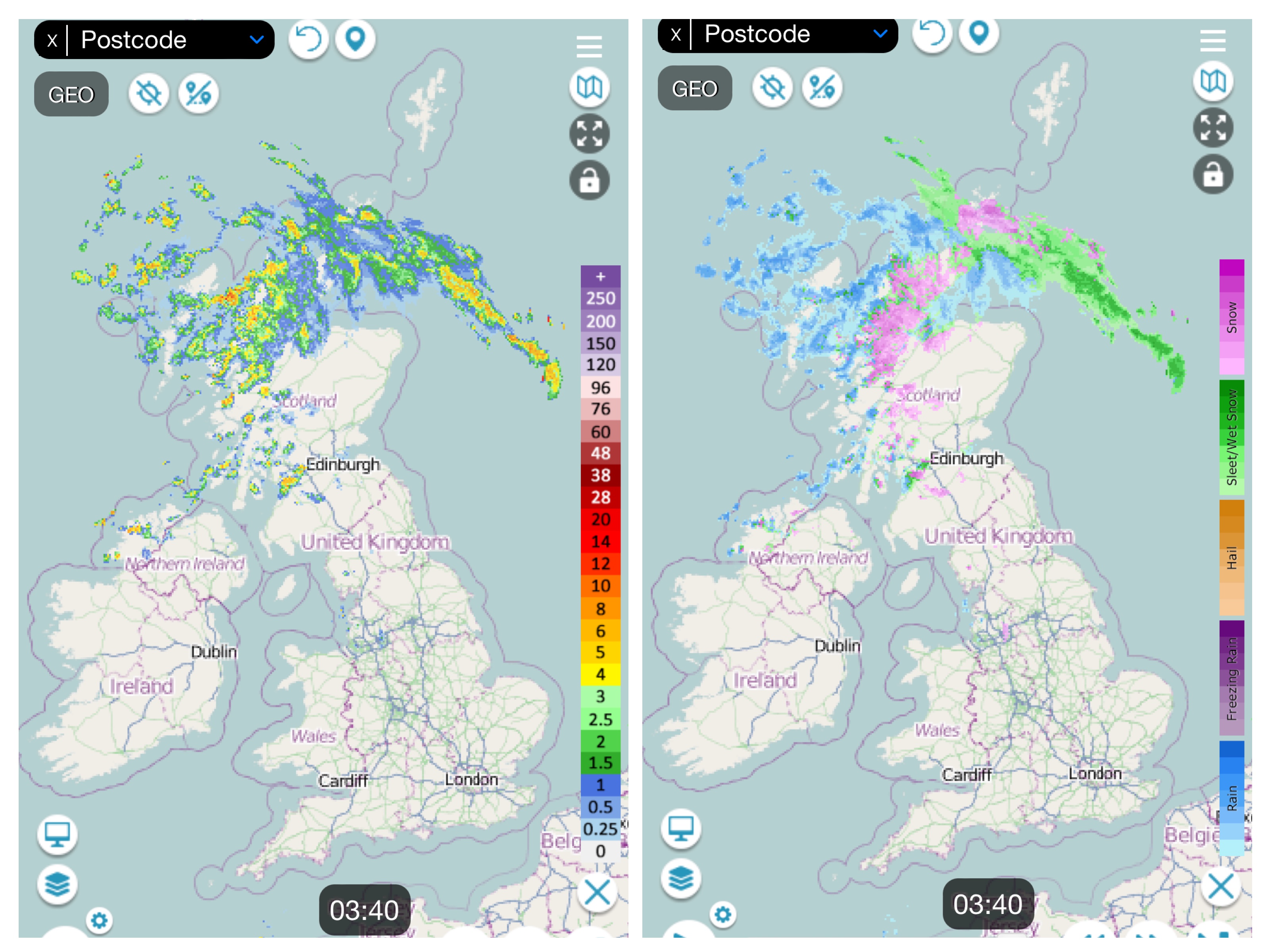
There are plenty of weather websites and apps that show rainfall images, including the Met Office. During the colder months, netweather.tv is useful to keep a closer eye on whether it's rain, sleet and snow.


 © Ed Hawkins, University of Reading")