
What is the NAO?
The North Atlantic Oscillation (NAO), discovered in the 1920s by Sir Gilbert Walker, describes the fluctuations in the surface pressure difference between the northern part and the tropical part of the North Atlantic Ocean. The value of this difference is calculated by subtracting the measured surface air pressure over Iceland from the measured surface air pressure at the Azores. Comparison of this instantaneous value with the long-term average pressure difference yields the North Atlantic Oscillation Index.
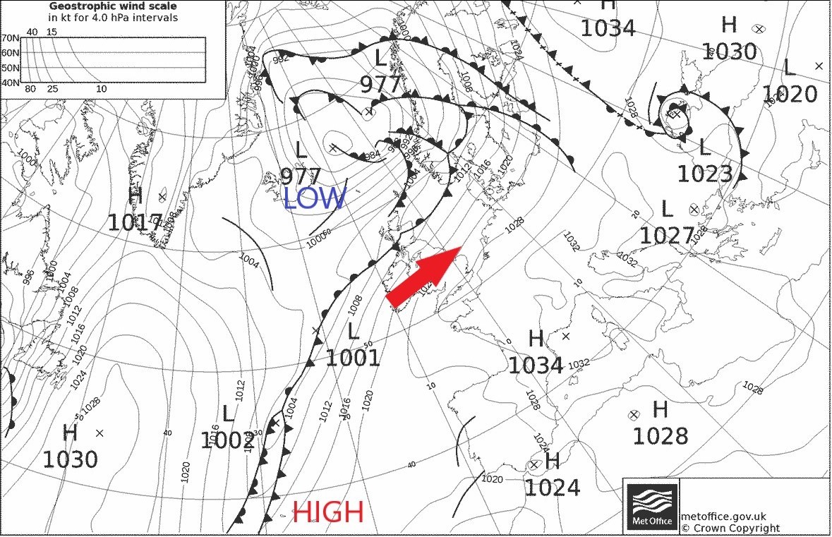
Image 1: Weather chart showing low pressure over Iceland (Icelandic Low) and high pressure near the Azores (Azores High) meaning the NAO Index is a positive number and the NAO is said to be in a positive phase. Over the UK, winds are westerly (red arrow).
In situations where the pressure difference is greater than average, the NAO Index is a positive number. This occurs when either the Icelandic pressure is lower than normal and/or the Azores pressure is higher than normal (Image 1). However, if the pressure near Iceland rises and/or the pressure near the Azores falls (Image 2), then the pressure difference becomes lower than normal and the NAO Index is negative.
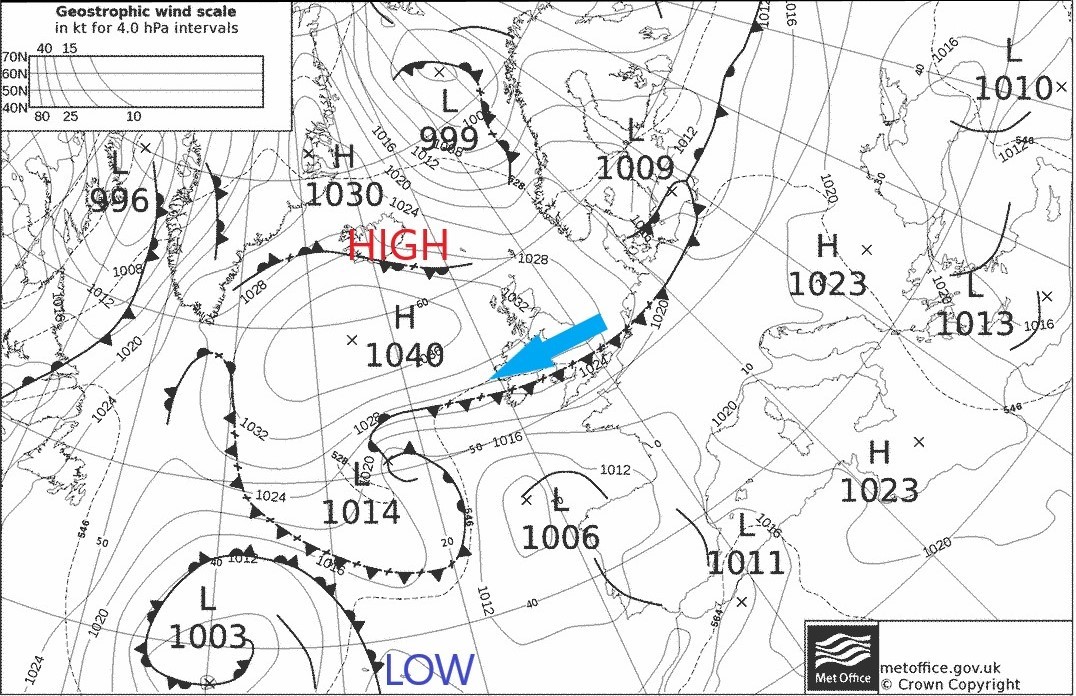
Image 2: Weather Chart showing the opposite situation to that in Image 1. High pressure near Iceland and low pressure near the Azores means the NAO Index is a negative number and the NAO is said to be in a negative phase. Over the UK, winds are variable, but often tend to be easterlies (blue arrow).
It is this continual fall and rise in the calculated pressure difference and the NAO Index which yields the name ‘North Atlantic Oscillation’ (Image 3). An example of when it is said to be in a positive phase is shown in Image 1. On the other hand, Image 2 shows an example of when it is in a negative phase.
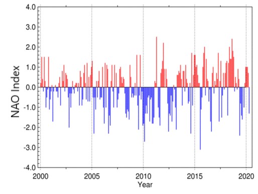
Image 3: Time series showing oscillating NAO Index since 2000. Credit: National Centers for Environmental Information / NESDIS / NOAA.
But what has this got to do with the actual weather ?
The surface wind generally blows along the line of the isobars seen on a weather chart; it is stronger when the isobars are closer together and, in the northern hemisphere, blows anticlockwise around an area of low pressure and clockwise around an area of high pressure. Applying this knowledge to the illustrations of the positive and negative phases of the NAO in Images 1 and 2 respectively, it is clear that strong westerly winds are likely in the vicinity of the UK during the positive phase. However, more variable winds, with a greater emphasis on easterlies, are found over the UK during the negative phase. In the winter, this means that a strongly positive phase is associated with mild, but occasionally stormy conditions and that a negative phase can be linked to a bitterly cold, polar continental, easterly airstream. Researchers can therefore use the NAO in order to categorise weather situations, so making it easier to study details in each phase.

