
Polar vortex, sudden stratospheric warmings and the Beast from the East
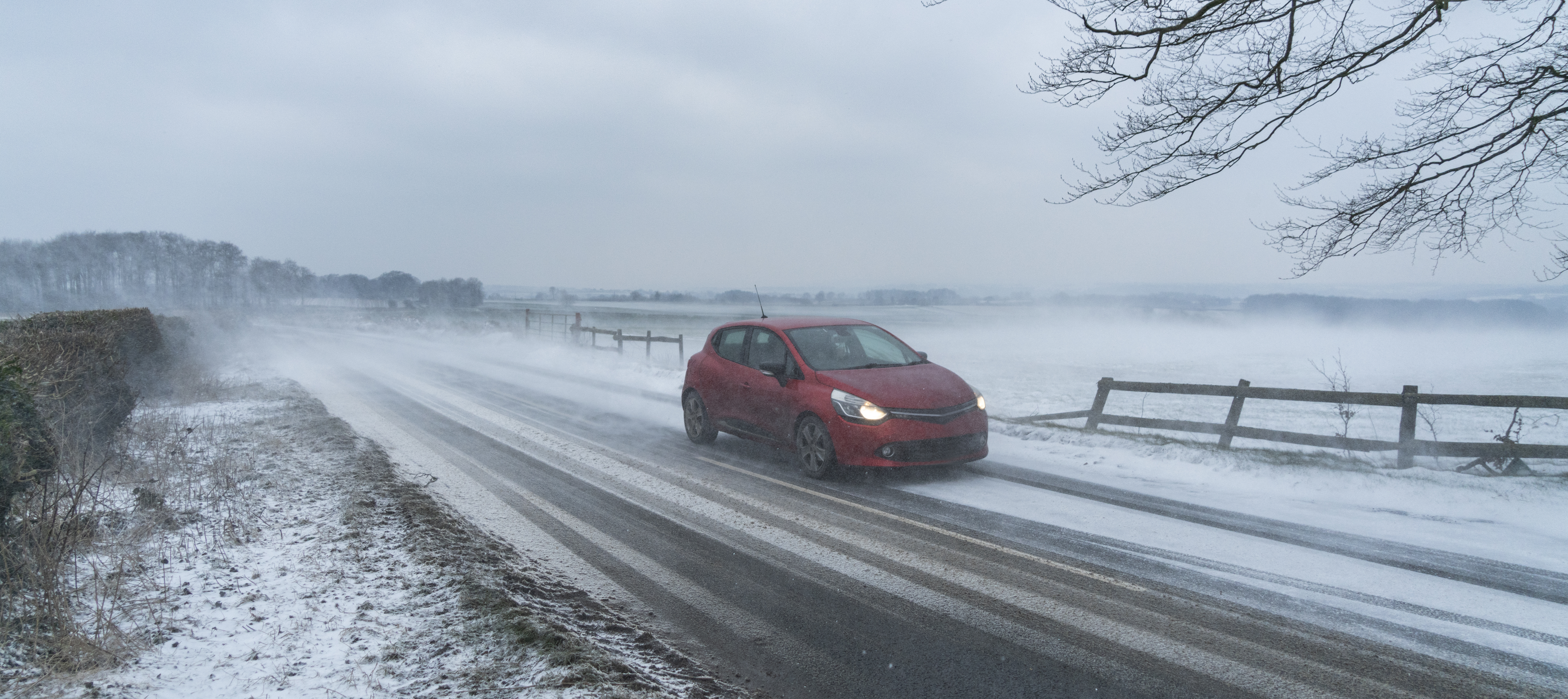
When people hear the phrase ‘sudden stratospheric warming’, many will immediately think about the ‘Beast from the East’ – a term associated with a spell of extremely cold weather and snow that impacted the UK during late February and early March 2018, following a sudden stratospheric warming. However, not all sudden stratospheric warmings are the same, and so the impacts they have on the weather in the UK can vary a lot. In other words, they do not always lead to a ‘Beast from the East’ (despite what you might read in the newspapers!).
What is the stratosphere?
Let’s start by looking at the structure of the atmosphere. The first layer of the atmosphere is the troposphere, extending from the Earth’s surface up to about 10km. This is where most of our weather takes place. Next we have the stratosphere – this is the layer of the atmosphere that extends from around 10km to around 50km above the Earth’s surface. Here in the stratosphere is where we find the polar vortex.
What is the polar vortex?
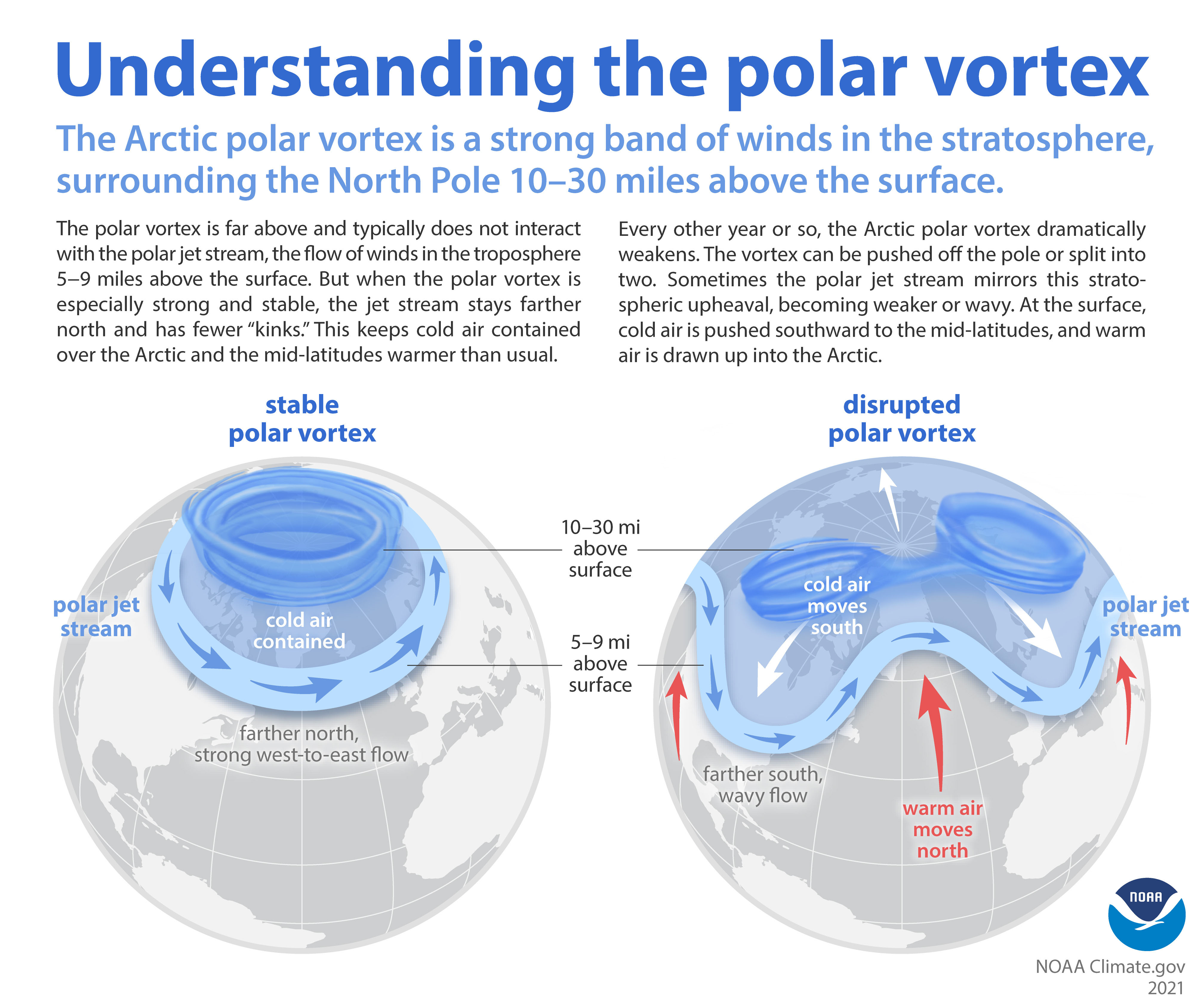
In the winter, the wintertime pole becomes a lot colder than the equator because it doesn’t get any sunshine to heat it up. This means that the air at the pole becomes very cold and dense, resulting in a strong jet stream forming in the stratosphere blowing from west to east around this cold air. This circulation of strong westerly winds in the stratosphere that forms every winter is called the polar vortex. A polar vortex circles around the Arctic in our winter and around the Antarctic during their winter.
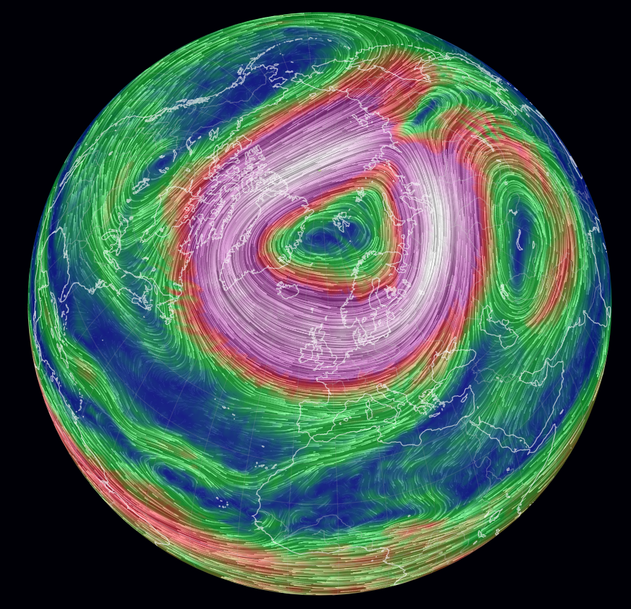
During the winter the polar vortex can strengthen and weaken, and these changes can have an influence on our weather in the troposphere.
A strong polar vortex favours a strong jet stream in the troposphere. Jet streams are fast flowing ribbons of air around 5 to 10km above the Earth’s surface that have a big influence on the weather in places like the UK. The polar jet or Atlantic jet stream, guides storm systems in from the Atlantic and forms a boundary between warm and cold air. Its location often changes over the course of a few days: wherever the jet stream is located tends to receive unsettled and very wet weather, with colder air to the north and warmer air to the south.
When the polar vortex is very cold and strong, it typically means the jet stream tracks further north towards the pole, meaning that northern parts of the UK and Scandinavia are very wet and the UK as a whole is very mild. December 2015 is an example of when the polar vortex was very strong – it was the warmest December on record for the UK and places such as Cumbria and Scotland saw extreme record-breaking rainfall.
Alternatively, when the polar vortex weakens and warms, the jet stream in the troposphere typically tracks much further south across Europe impacting places such as Spain, Portugal and the Mediterranean. This means that southern parts of Europe are milder and very wet, while the UK and northern Europe can experience more frequent spells of northerly or easterly winds. In the winter, these winds bring cold air as well as the risk of snow.
There are times when the polar vortex can break down entirely in an event called a sudden stratospheric warming. These events have been linked to spells of extremely cold weather in the winter in the UK, such as the ‘Beast from the East’ in 2018.
What is a sudden stratospheric warming?
A sudden stratospheric warming refers to a rapid warming in the stratosphere between 10km to 50km above the Earth’s surface. In some years, the winds in the polar vortex can temporarily weaken or even reverse in direction – so instead of flowing west to east they flow east to west. Air descends into the vortex and warms rapidly as it is compressed.
In the most extreme sudden stratospheric warmings, the temperatures in the stratosphere can rise by up to 50 to 60 °C in just a few days – so the temperatures in the winter over the poles can go from around -50 °C to zero or maybe slightly above in a matter of days, even in the depths of winter when the Arctic is receiving no sunlight. Knock-on effects on the jet stream in the troposphere can follow a few weeks later and this can affect the weather we experience down on the ground.
Scientists can reliably predict individual sudden stratospheric warmings about 1-2 weeks in advance. This means there is time to see how they develop and how they may impact our weather in the future. A sudden stratospheric warming typically takes a few weeks to have maximum impact on our weather, but its influence can last for up to 2 months.
Impacts of a sudden stratospheric warming on our weather
It is important to note that even though the polar vortex forms every winter, a sudden stratospheric warming doesn’t occur every year. And even when it does occur, the impacts on our weather can vary. In fact it doesn’t always affect our weather. In the last four decades there have been around 25 major sudden stratospheric warmings.
In some cases, a sudden stratospheric warming can lead to a large area of high pressure forming to the north of the UK and over Scandinavia, leading to easterly winds across the UK. These winds can draw in cold polar continental air from Europe and bring an increased risk of heavy snow aka the ‘Beast from the East’.
However, this is not the case for all sudden stratospheric warmings. For example, a sudden stratospheric warming in January 2019 had no significant impact on the UK’s weather and it actually stayed mild for the rest of the winter. The most recent sudden stratospheric warming in January 2021 led to some cold weather in the UK, which was dubbed the ‘Beast from the East 2.0’ at the time but was much less severe than the event in 2018.
It is important to note that the effect of a sudden stratospheric warming on our weather can vary a lot as there are also a lot of other things going on in the global circulation that play a part. The polar vortex is just one piece of the puzzle. So just because there has been a sudden stratospheric warming does not mean we will experience another ‘Beast from the East’.
Special thanks to Simon Lee (@SimonLeeWx), postdoc at Columbia University, for his input to this article.
About the Author
Gemma Plumb, FRMetS has been a meteorologist for 15 years and is currently working for DTN as a media meteorologist at the BBC. She has also forecast for a variety of sectors including energy, media, transport and utilities.
Gemma is one of the creators and hosts of the weather podcast - For the Love of Weather - which looks at the science behind weather and climate and how weather can impact our daily lives.
A keen science communicator, she is passionate about sharing her love of the weather. You can find Gemma on TikTok making funny, engaging and educational weather-related videos (@theweatherpud).
 © Ed Hawkins, University of Reading")


