
Weather Satellites
by Dr. Peter N. Francis. Manager at Satellite Imagery Applications Group, Met Office, UK.
Observations of the weather are made 24 hours a day, all over the world. The main observations are from weather satellites, balloons, landbased instruments, ships, buoys and aircraft.
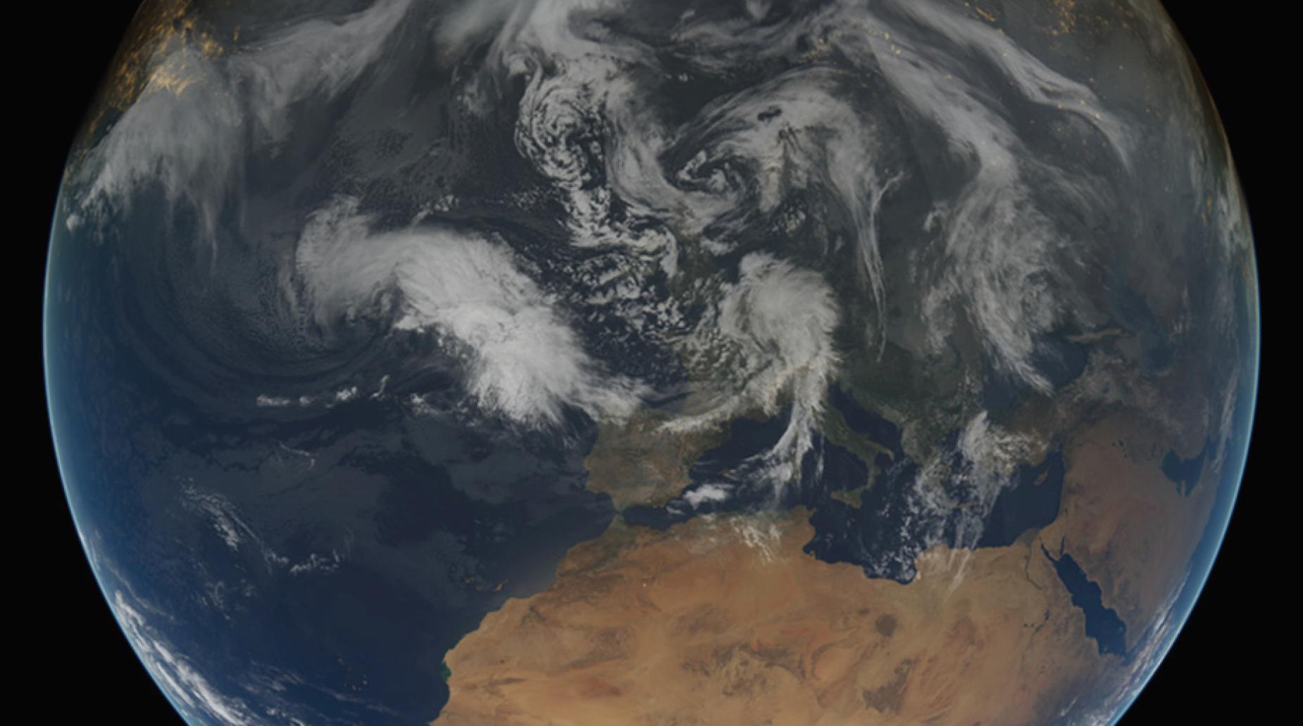
Since the launch of the first weather satellite (TIROS-1) in 1960, observations made from space of the Earth’s atmosphere, oceans and land surfaces have become an increasingly important part of the overall global observing system. Historically, the success of satellite observations lay in their ability to provide routine pictures of the Earth and its atmosphere in sufficient detail, and sufficiently quickly, to provide forecasters with guidance on the location and development of synoptic-scale features such as mid-latitude depressions and tropical cyclones. Over time, though, newer technology has enabled satellite data to be acquired with better spatial resolution, temporal coverage, and at many more wavelengths in the electromagnetic spectrum. Satellite observations now provide information on the atmosphere’s temperature and humidity profiles, clouds, aerosols, winds, sea surface temperatures, sea ice extent, land surface properties, and many others. The data continues to be used by forecasters as before, but have also proved to be a key tool in improving our understanding of the physical processes affecting our weather. As the longevity of the satellite datasets increases, they are also being used increasingly for climate monitoring purposes.
Weather satellites tend to fly in two basic types of orbit. The first is usually referred as a low-Earth orbit – typically flying at around 850 km above the Earth’s surface – and providing near-global coverage twice a day. The second type is a geostationary orbit – here, the satellite is around 36,000 km above the surface, where it has a 24 hour orbital period and therefore appears to be stationary over a fixed point on the Equator. The advantage of this type of orbit is that it allows very frequent sampling of the same Earth location (e.g. the SEVIRI imager on Europe’s Meteosat satellites provides images of Europe, the Atlantic Ocean and Africa every 15 minutes), enabling forecasters to monitor rapidly changing weather conditions.
The main advantage of low-Earth orbits is that, being much closer to the Earth’s surface, they allow image features to be resolved in much finer detail. For example, some of the visible channels on NASA’s MODIS imager (flying on two research satellites) have a pixel resolution of 250 m, compared with a typical geostationary pixel resolution of around 5 km. Importantly, low-Earth orbit satellites also tend to house sounding instruments – these are not designed to produce pictures such as those acquired from (usually visible and infrared) imagers such as SEVIRI, but rather measure radiation emitted (at many wavelengths in the microwave or infrared regions of the spectrum) that allow information on the atmosphere’s temperature and humidity profiles to be assimilated into Numerical Weather Prediction systems at National Weather Services and elsewhere, improving the models’ initial conditions, and hence increasing the skill of the NWP forecasts.
Whilst most satellite instruments sense naturally-occurring radiation (so-called “passive” sensors), some emit their own radiation and measure the back-scattered signal – so-called “active” sensors. Examples include scatterometers for measuring nearsurface ocean winds, and radars for measuring precipitation and cloud properties.
Aside from weather, satellites can also be vital for monitoring environmental hazards. During the eruptions of the Icelandic volcanoes Eyjafjallajökull and Grímsvötn, in 2010 and 2011 respectively, satellite data played a very important role in pin-pointing the locations of the ash plumes, enabling suitable airspace restrictions to be put in place.


