What is wind?
by Kirsty McCabe, FRMetS
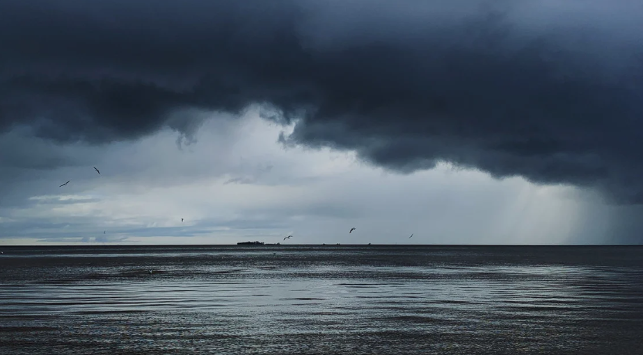
When we’re talking about the weather, most people want to know if it’s hot or cold, wet or dry. But I would argue that it’s more useful to know what the wind is doing, as it can have a far bigger impact, from dangerous gusts to deadly wind chill.
What is wind?
In simple terms, wind is the movement of air. This movement is caused by pressure differences, which in turn were caused by temperature differences. In other words, it all starts with the sun. As the sun warms the earth’s surface, the atmosphere warms too. But thanks to our hills and oceans, the heating is uneven, not to mention that the poles receive less solar energy than the equator.
The difference in solar input, combined with the earth’s rotation, generates our global atmospheric circulation patterns and prevailing surface winds. Hot air rises from the equator, moves north towards the poles, sinks and flows south to replace the air at the equator.
On a smaller scale, uneven solar heating leads to pockets of high and low pressure. As air is warmed it expands and rises, leaving behind an area of low pressure. Air will move from surrounding higher pressure areas to try to even things out, and it’s this rush of air that results in wind. The bigger the pressure difference, the faster the air will move. The earth's rotation means that air does not flow directly from high to low pressure, instead it is deflected to the right (in the northern hemisphere). Known as the Coriolis effect, it gives us our prevailing west to southwesterly winds across the British Isles.
Wind direction
If you've ever wondered whether a westerly wind means the air is coming from the west or going to the west, then think of the rhyme “The north wind doth blow and we shall have snow”. The wind is always named after the direction it is coming from. The direction our wind is blowing from can reveal what sort of weather to expect thanks to air mass theory.
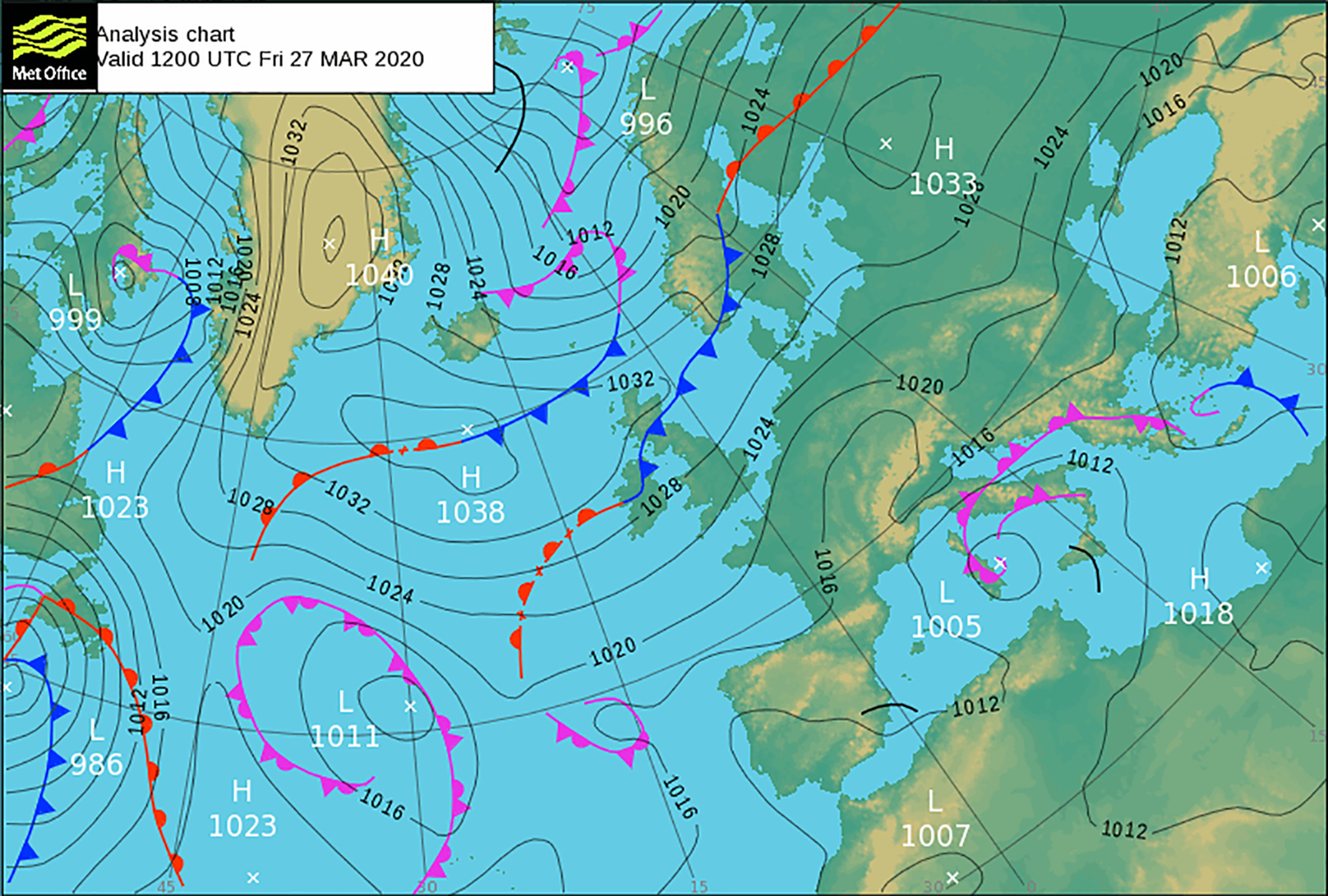
A quick glance at the isobars on a pressure chart can reveal wind speed and direction (take a closer look here if you aren't sure how to do this). And if we do get a brisk northerly or an easterly in winter, don’t forget about that wind chill!
Measuring wind
Wind speed is measured using an anemometer in an open space, as trees, hedges and buildings can affect both speed and direction. It’s worth noting that the wind speeds you hear quoted in weather forecasts are always measured at 10 metres above the ground. This doesn’t always reflect the wind speeds felt nearer the ground, which can be less than half as much.
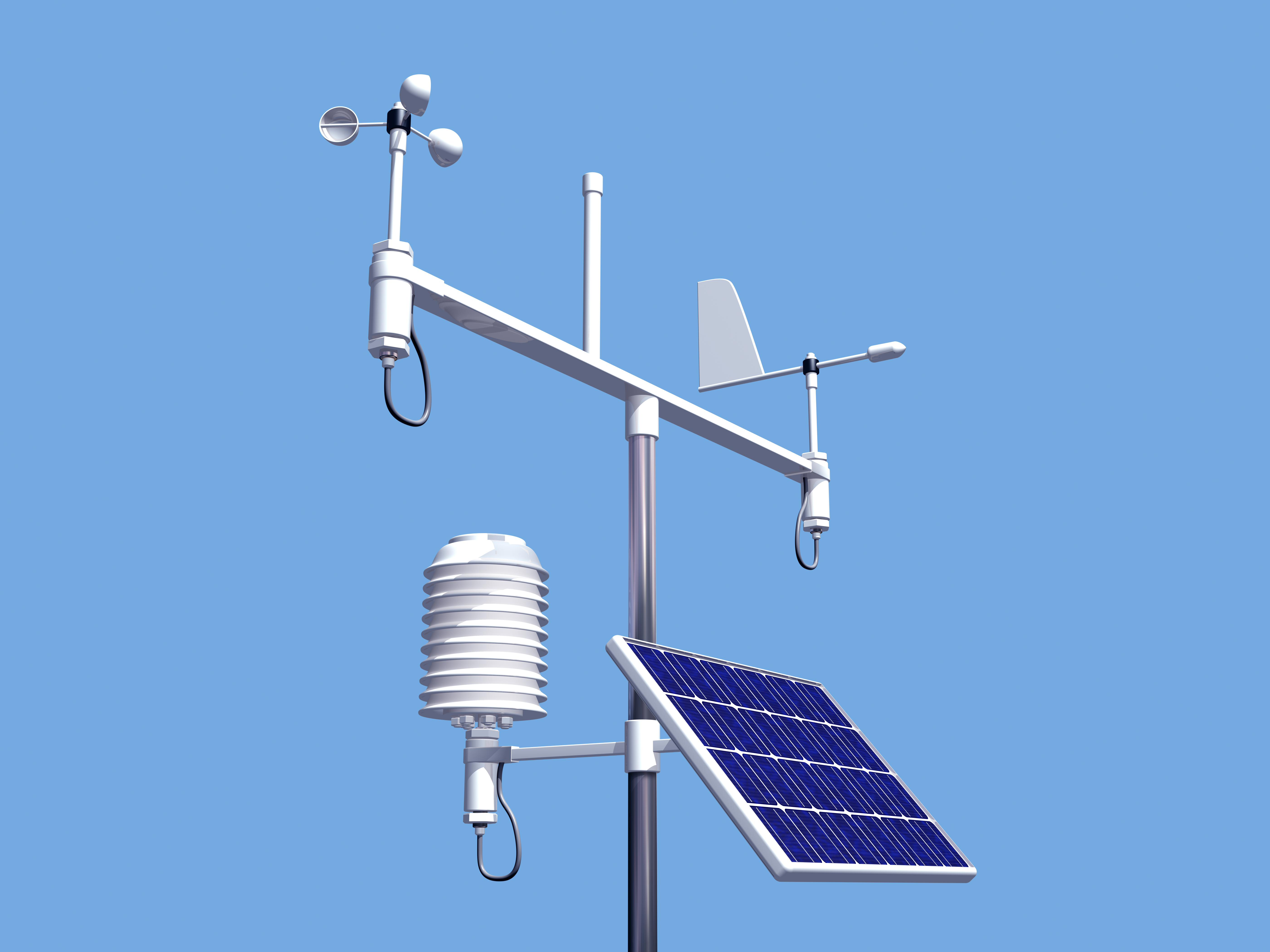
As well as an anemometer, a wind vane is also attached to the top of the 10 metre mast to measure the wind direction. Special heated sonic anemometers with no moving parts are used in extreme weather conditions.
Around 1806, the British naval commander Sir Francis Beaufort created the Beaufort Scale, which we still use to describe wind strength today. The Beaufort wind force scale is an empirical measure that relates wind speed to observed conditions at sea or on land. Prior to this there was no standard scale, so weather observations could be very subjective.
Wind Force | Description | Wind Speed | Specifications | Probable Wave Height | Sea State | |||
| km/h | mph | knots | metres | Max |
| ||
0 | Calm | <1 | <1 | <1 | Smoke rises vertically. Sea like a mirror | -- | -- | 0 |
1 | Light Air | 1-5 | 1-3 | 1-3 | Direction shown by smoke drift but not by wind vanes. Sea rippled | 0.1 | 0.1 | 1 |
2 | Light Breeze | 6-11 | 4-7 | 4-6 | Wind felt on face; leaves rustle; wind vane moved by wind. Small wavelets on sea | 0.2 | 0.3 | 2 |
3 | Gentle Breeze | 12-19 | 8-12 | 7-10 | Leaves and small twigs in constant motion; light flags extended. Large wavelets on sea | 0.6 | 1.0 | 3 |
4 | Moderate Breeze | 20-28 | 13-18 | 11-16 | Raises dust and lose paper; small branches moved. Small waves, fairly frequent white horses | 1.0 | 1.5 | 3-4 |
5 | Fresh Breeze | 29-38 | 19-24 | 17-21 | Small trees in leaf begin to sway; crested wavelets form on inland waters. Moderate waves, many white horses | 2.0 | 2.5 | 4 |
6 | Strong Breeze | 38-49 | 25-31 | 22-27 | Large branches in motion; whistling heard in telegraph wires; umbrellas used with difficulty. Large waves, extensive foam crests | 3.0 | 4 | 5 |
7 | Near Gale | 50-61 | 32-38 | 28-33 | Whole trees in motion; inconvenience felt when walking against the wind. Foam blown in streaks across the sea | 4.0 | 5.5 | 5-6 |
8 | Gale | 62-74 | 39-46 | 34-40 | Twigs break off trees; generally impedes progress. Wave crests begin to break into spindrift | 5.5 | 7.5 | 6-7 |
9 | Strong Gale | 75-88 | 47-54 | 41-47 | Slight structural damage (chimney pots and slates removed). Wave crests topple over, and spray affects visibility | 7.0 | 10.0 | 7 |
10 | Storm | 89-102 | 55-63 | 48-55 | Seldom experienced inland; trees uprooted; considerable structural damage. Sea surface is largely white | 9.0 | 12.5 | 8 |
11 | Violent Storm | 103-117 | 64-72 | 56-63 | Very rarely experienced, accompanied by widespread damage. Medium-sized ships lost to view behind waves. Sea covered in white foam, visibility seriously affected | 11.5 | 16.0 | 8 |
12 | Hurricane | 118+ | 73+ | 64+ | Devastation.
| 14+ | --- | 9 |
Note the speeds are mean speeds, usually averaged over 10 minutes, and do not capture the speed of wind gusts. The specifications are descriptions of likely observations on land or at sea, and the probably and maximum wave heights (in metres) are quoted for the open sea. The figure for sea state (on a scale from 0 to 9) is a shorthand way of describing the sea surface conditions to various users.
Famous winds
You’ve probably heard of sea breezes, but there are plenty of other special winds out there, including mountain and valley breezes, and katabatic and anabatic winds. Many local wind patterns also have their own name, from the snow-eating Chinook to the warmth of the Föhn.