
September heatwave: late summer warmth and spectacular Saharan sunsets
by Kirsty McCabe, FRMetS
At the start of September 2023, heatwave conditions developed over parts of the British Isles as temperatures soared both by day and night. But what caused the hot weather and how unusual is it to see temperatures above 30°C in September?
The scorching summer heat, record-breaking temperatures, drought and devasting wildfires that affect places like North America and southern Europe are often caused by “heat domes”, formed when an area of high pressure stays over the same place for days or even weeks, trapping very warm air underneath – rather like a lid on a pot.
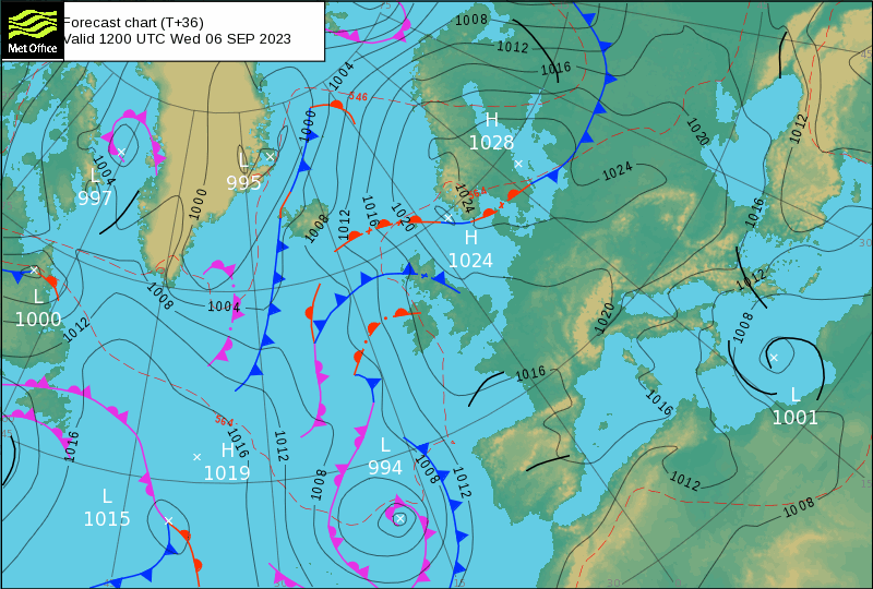
But the late summer warmth that developed over the British Isles was caused by a different set up. Tropical storms in the North Atlantic influenced the jet stream, causing it to bend and weaken, resulting in a blocking pattern known as an omega block.
This is where an area of high pressure is sandwiched between two low pressure systems, forming a shape like the Greek letter Ω, hence the name. Just like heat domes, omega blocks can persist for days, weeks or even months, like in the summer of 1976.
The result in September 2023 was a flow of air from the south, and that meant a plume of hot and humid air all the way from north Africa heading to the British Isles. However, either side of the Mediterranean was hit by deep areas of low pressure, with torrential flooding for Iberia and Greece.
A heatwave is a prolonged period of excessively hot weather which has different definitions around the world relative to the average temperature and weather for a specific location.
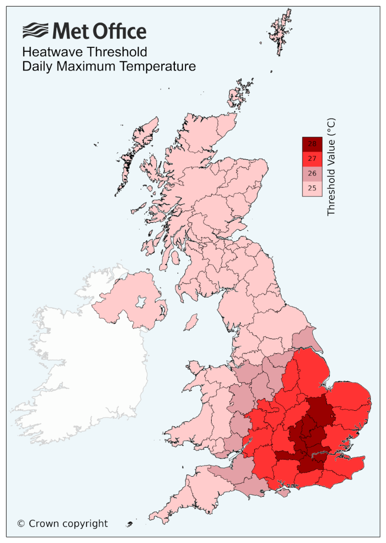
In the UK, the Met Office has defined a heatwave temperature threshold for each county – if the daily maximum temperature meets or exceeds this value for at least three consecutive days, it is officially classed as a heatwave. The figure below shows the threshold values for each county, ranging from 25°C to 28°C.
Unfortunately timed for returning schoolchildren, the late summer warmth of 2023 could spark a spate of new September temperature records, before ending with a thundery breakdown. Temperatures of 30°C in September used to happen around once every seven years, but in recent decades it has happened more frequently, and that is linked to climate change. Reaching 31 or 32°C is even rarer, just a handful of times so far this century.
The nights were also close to record-breaking with tropical nights – where temperatures stay above 20°C all night – for parts of southern Britain. The current September overnight minima record stands at 21.7°C at St James Park, London, set in 1949.
While the UK's highest September temperature ever recorded was not broken this time (35.6°C in South Yorkshire in 1906), we did get the highest temperature of 2023. Temperatures in the summer had peaked at 32.2°C (90°F) at Chertsey on 10 June and Coningsby on 25 June. But the UK had an unprecedented and record-breaking seven consecutive September days of 30°C heat (4 to 10 September 2023), with a maximum temperature of 33.2°C at Kew Gardens on 9 September 2023. The last time the highest temperature of the year occurred in September was in 2016, when Gravesend reached 34.4°C on 13 September 2016.
#SaharanDust across W Europe on 5 Sept with #CopernicusAtmosphere regional ensemble forecast daily max dust concentration at 0m↙️ & 3000m↘️ showing some surface values for Spain/France but long-range transport at higher altitude. Data available from https://t.co/Wl8WdTrWBL https://t.co/P7MNMeswUT pic.twitter.com/NDeoUoii2k
— Mark Parrington (@m_parrington) September 5, 2023
A plume of warm air from North Africa doesn't just bring hot weather, a strong southerly flow can bring with it Saharan dust, leading to some spectacular sunrises and sunsets.
Warm spells during autumn are not uncommon, but late summer warmth in September is not an Indian Summer. That term refers to a warm, calm spell of weather that usually occurs in October and November after the first autumn frosts.
Standard Chartered Weather Photographer of the Year shortlist
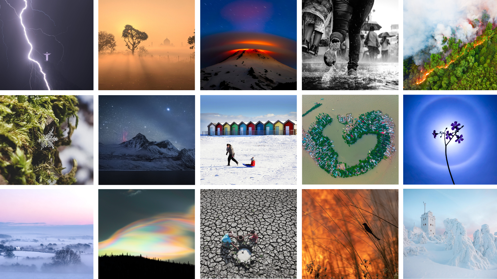
The public vote for the 2023 Standard Chartered Weather Photographer of the Year competition is now open! Now in its eighth year, the competition is a window to the vastly different climates experienced across the world and provides an international platform to highlight global weather events.
The 2023 competition showcases some of the world’s most striking weather phenomena, alongside images that narrate compelling stories about the impacts of climate change. Highlights include rare red sprite lightning, dramatic tornadoes and cloud formations, ice-covered landscapes, flood-filled streets, dry riverbeds and deadly forest fires. The shortlisted images, from photographers across 94 countries, emphasise the beauty and fragility of our weather and the urgency to limit further global warming while adapting to the changes we are already experiencing.
The Society now invites you to vote for your favourite photograph from a shortlist of the competition's finest entries. The winners of the 2023 Standard Chartered Weather Photographer of the Year competition will be announced on Thursday 5 October, after the public vote closes on 24 September.
 © Ed Hawkins, University of Reading")


