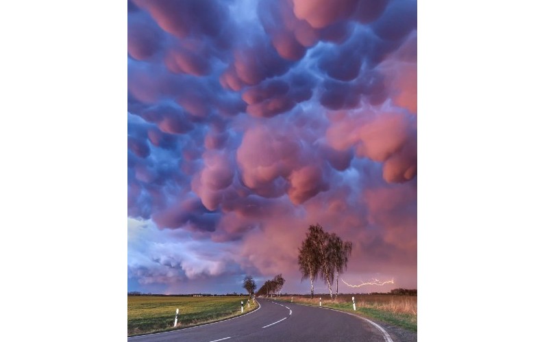
Mammatus Outbreak © Boris Jordan
Photographer name: Boris Jordan
From: Frankfurt am Main, Germany
Age: 37
Photo title: Mammatus Outbreak
Photo location: Not far away from Leipzig (Saxony, Germany)
Date photo taken: 04 April 2018
Story behind the photo: This was by far the most spectacular mammatus display I've ever seen in my entire life. After a line of thunderstorms passed by and the sun disappeared behind the horizon, low-hanging mammatus clouds began to shine red and blue. At this moment I was just speechless, as the sky really looked like not from this planet. And as a nice bonus, a distant lightning made the composition perfect.
Mammatus mostly appear in association with strong thunderstorms, if the sinking air, which contains high amount of liquid water or ice, is cooler than the surrounding air.
Weather caption: Mammatus are a type of cloud that look like a series of pouches hanging from the sky, resembling cow udders. They typically develop on the underside of a thunderstorm’s anvil and are a result of moist, cold air sinking into dry air. A common misconception is that their presence means a tornado is about to form, but this is untrue. What can be said is that they form in the most unstable cumulonimbus clouds, which can bring heavy rain, strong winds, hail, and lightning. Whilst extraordinary on their own, they are particularly striking during sunset.